 Site")
Cleanup Status Across the Basin
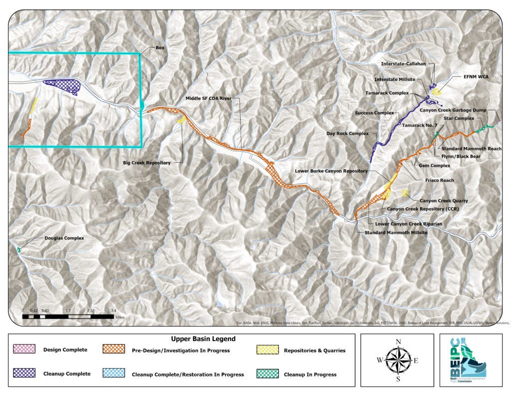
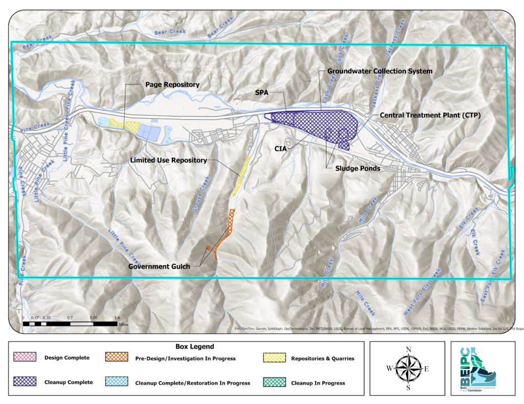
The Bunker Hill Superfund Site (BHSS) covers a large geographic area. To clearly show where cleanup work stands today, we’ve organized information into three map views: the Upper Basin, Lower Basin, and the Box (the historical mining and smelting area).
Each map provides a snapshot of current conditions and project status across the site.
How to Use These Maps
These maps are static snapshots in time showing where projects are in the cleanup process. Because these maps are static:
- They reflect conditions at the time they were created
- Some projects may have progressed since publication
- For the most current project-level details, additional resources may be available
- Not all remedial actions are shown (i.e. yard and road remediations)
- Completed clean-up status may reflect partial or capped remedial actions
All three maps use the same legend, allowing you to easily compare progress across different areas of the Basin. Locations are categorized by their current stage of work:
- Pre-Design – Site evaluation and planning are underway
- Design Complete – Cleanup plans have been finalized and are ready for implementation
- Cleanup in Progress – Active remediation or construction is occurring
- Cleanup Complete – Construction is finished; sites may move into long-term monitoring
- Cleanup Complete / Restoration in Progress – Cleanup construction is finished and restoration (such as revegetation or habitat work) is underway
- Repositories – Approved locations for disposal of contaminated materials
Upper Basin
Lower Basin

The Box
Why This Matters
Tracking where cleanup is complete—and where work is still underway—helps illustrate the long-term effort to reduce risks to human health and the environment across the Basin.
Together, these maps provide a basin-wide view of progress and remaining work within the BHSS.